Physical Security
Neighborhoods where residents feel protected from physical harm. Most residents see a role for police in that protection but emphasize a need for community-led policing that can build alternatives to violent policing and foster relationship-and trust-building. A security force that is community-directed was described as an approach that could reduce incarceration and violence, and provide safety for the whole community.
Areas within Physical Security that residents found to be most important for safety and thriving.
The following indicators are meant reflect the conditions underlying community safety and thriving.
Police Misconduct & Force
Residents and police fear each other in ways that lead to police misconduct and undermine the safety of residents. Decreased use of force and invasive policing is a key measure of increased safety.
Police-involved deaths
Responsible NYC/Gov Agency: NYPD
Description: number of police-involved deaths
Public Data Available? No.
Included in ONS Neighborhood Navigator: No.
Data Concern/Recommendation: Public data should be released on Police-Involved deaths.
NYPD Misconduct Complaints
Responsible NYC/Gov Agency: CCRB & NYPD
Description: Misconduct complaints by precinct
Public Data Available? Yes.
Included in ONS Neighborhood Navigator: No.
Data Concern/Recommendation: Public data should allow for more geographic precision and be updated more frequently.
NYPD misconduct investigations
Responsible NYC/Gov Agency: CCRB & NYPD
Description: Percent of complaints investigated by precinct
Public Data Available? Yes.
Included in ONS Neighborhood Navigator: No.
Data Concern/Recommendation:
Public data should allow for more geographic precision and be updated more frequently.
Use of force
Responsible NYC/Gov Agency: NYPD
Description: number of stops by precinct
Public Data Available? Yes.
Included in ONS Neighborhood Navigator: No.
Data Concern/Recommendation: Public data should allow for more geographic precision and be updated more frequently.
Stop and frisk
Responsible NYC/Gov Agency: NYPD
Description: number of stops by precinct
Public Data Available? Yes.
Included in ONS Neighborhood Navigator: No.
Data Concern/Recommendation: Public data should allow for more geographic precision and should updated more frequently.
How residents talk about Physical Security
How do residents feel about Physical Security?
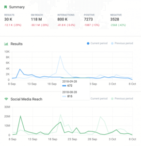
[Safe Lab Chart]
FAQ
Q: Is this data available?
A: All the data provided in the data explorer can be downloaded from the NYC Open Data Portal. All of the other data included as samples or recommended for data collection can be sourced from the NIS report but is not readily available.
Q: What are some actionable steps as a NYC resident?
A: First, we encourage you to review the NIS Safety and Metrics report. Second, encourage the relevant NYC agencies to improve data collection efforts, quality, frequency, and granularity. Third, hold government accountable around safety by pushing accountability across all agencies – every agency discussed has some role to play in co-producing safe and thriving communities.
Q: Who should I contact if I see errors or concerns in the data explorer?
A: Please email map@cityhall.nyc.gov with the subject “ONS Neighborhood Navigator Issue.” Someone from our team will get back to you 🙂
Q: When will the social media data be made available?
A: The SAFE Lab Social media tool is currently under research and development but will be made available in 2022. To keep up to date, please revisit this site for more information.
Feedback
Have questions? Want to get involved? Reach out to us via the following:
Email us at map@cityhall.nyc.gov
Subscribe to our newsletter for updates and info
Follow us on Instagram @nstatnyc
For press inquiries: mocjpress@cityhall.nyc.gov
